Pre-Dredge Bathymetric and Sub-bottom Survey of a pond at a golf course
Background
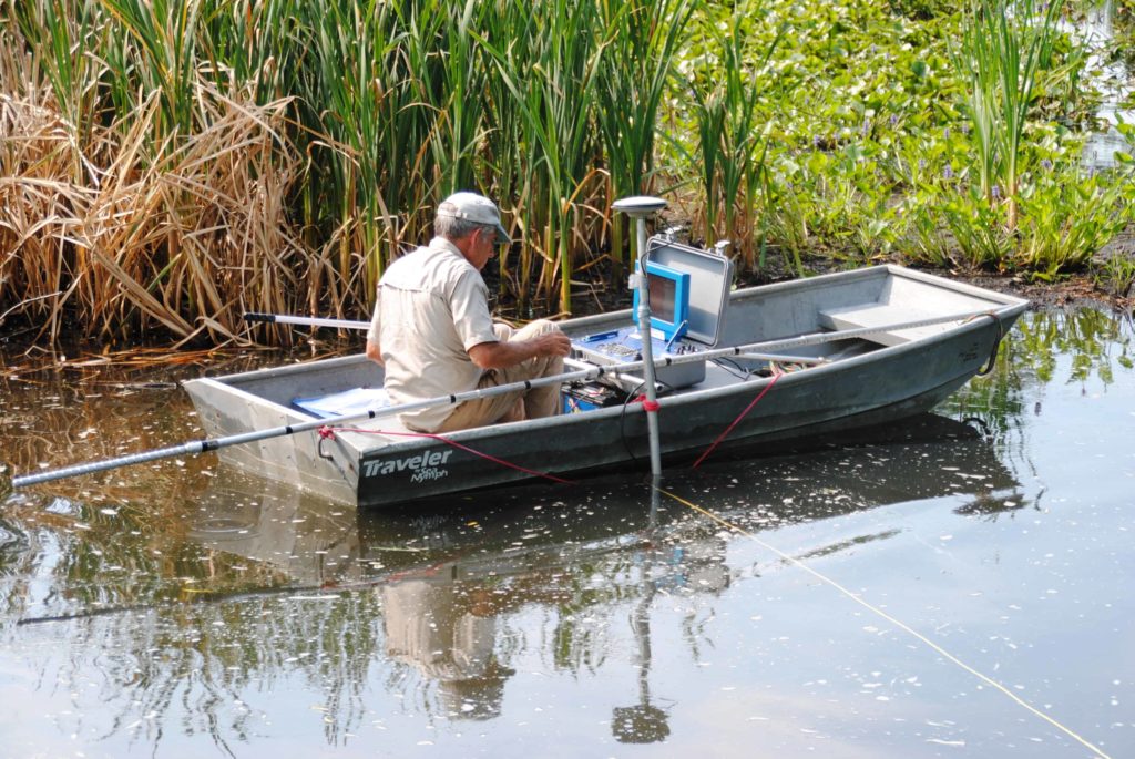
Specialty Devices, Inc. (SDI) was contracted by ENVIROdredge to perform a pre-dredge bathymetric and sub-bottom survey of one of the flood control ponds located in Burning Tree Country Club, Greenwich, Connecticut. The survey objective was to map the existing water bottom and sediment bottom by combining an acoustic bathymetric survey and vibracore sampling.
Survey
The surveyed pond serves as a flood control pond in Burning Tree Country Club, Greenwich, Connecticut. SDI provided equipment and personnel to perform this survey. The survey equipment was selected to accommodate the limited access and shallow water present at the survey site. The acoustic bathymetric survey was performed using an SDI manufactured SC-200 Bathymetric Survey System. The SC-200 system is equipped with a survey depth sounder for bathymetric data and a DGPS navigation system to provide the geographic information. Due to the shallow water present at the site, the acoustic survey was limited in the northeast portion of the surveyed pond. sediment push data and vibracore data was used to provide both bathymetric and sub-bottom information. Four core samples were taken at four different locations by using SDI VibeCore Mini-H for a core sample visual analysis.
Equipment Used
Results
A total of 10882 acoustic data points were collected to create a bathymetric contour map and sediment isopach contour map for the surveyed pond. Four vibracoring sample and thirty-six push probes ware sampled throughout the pond to provide supplemental bathymetric information and sub-bottom information.
Field Pictures


Joe Williams
My name is Joe Williams. I am the owner of Piedmont Irrigation and Land Development Co. in Watkinsville, GA. We are expanding into pond and lake dredging using a Dino 6 hydraulic dredge. We are focusing on the golf and park industries because my partner an I have a combined 40+ years of experience in the golf course construction and maintenance industry. We understand the importance of preserving the golf course condition, not interrupting play, and the infrastructure of the irrigation pump stations and drainage systems on golf courses. I have been researching a way to get an underwater map of what the sediment plumes look like in ponds. This would help me with cubic yard estimation as well as presenting the owner with before and after dredge pictures or maps of the work done. The yellow remote control “boat” is what I have been envisioning as the ultimate survey tool. I am sure the cost of even leasing that equipment would be hefty. Can you enlighten me on the cost of buying and leasing this equipment? What other equipment or programs would be necessary for the compilation of the data to make a map of the pond or lake bottom? What else should I know about this service and equipment?